To help you locate various services and facilities within Leighton Buzzard, please take a moment to familiarise yourself with the town by using the range of downloadable maps identified below. Many of the excellent shops and facilities are within walking or cycling distance or by using the new Dash Direct (D1) Bus Service, provided by the Southern Leighton Buzzard Steering Group.
Click on the maps to view larger versions.
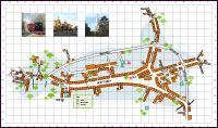
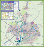
Town Centre Map
Bus Routes Map
Bus routes throughout Leighton Buzzard
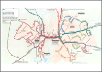
Route of the Dash Direct (D1) Exemplar bus service. Connecting Southern Leighton Buzzard, Sandhills, Leighton Buzzard high street and railway station.
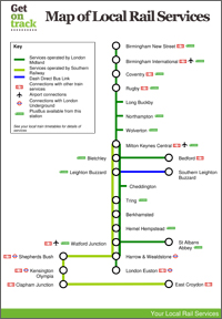
Rail Map
Cycle Route Maps
To help you discover the surrounding area by cycle, why not download one of these printable cycle maps to help plan your route.
Cycling in Leighton Linslade: A comprehensive town map of Leighton Linslade highlighting all the key cycling routes along with many suggested low traffic routes and all local footpaths – download a PDF here.
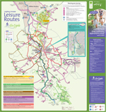
Leisure routes: 6 carefully selected leisure routes for a range of abilities from family through serious distance cyclists to the hardcore off-roader – download a PDF here.